背景
想复现“Enhanced Crop Mapping Using Polarimetric SAR Features and Time Series Deep Learning: A Case Study in Bei’an, China”中的方法
1 需要的数据
Sentinel 1的数据:使用数据S1A_IW_SLC__1SDV_20250729T111524_20250729T111551_060298_077E66_0DEE.SAFE.zip
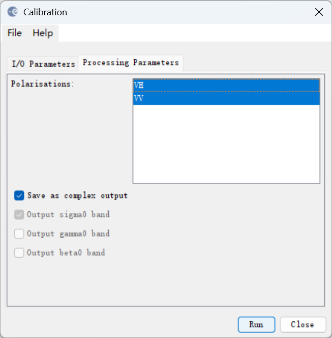
2 Radiometric Calibration(辐射定标)
Radar → Radiometric → Calibrate
选择参数如下:
✔ Output in complex (勾选!⚠️)
✔ Selected Polarisations:VV, VH
✔ Output Sigma0
✔ Preserve Polarity (这个没有找到 )
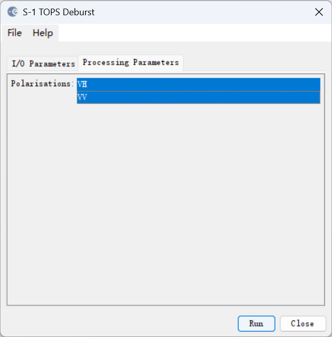
3 Deburst
Radar → Sentinel-1 TOPS → TOPSAR-Deburst
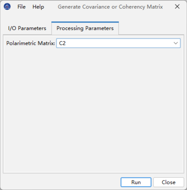
4 构建协方差矩阵 C2(核心)
Radar → Polarimetric → Polarimetric Matrix Generation
Matrix type:C2
Polarisation basis:Lexicographic (这个貌似没有)
Window size:3 × 3 或 5 × 5(论文未强调,任选,这个貌似没有)
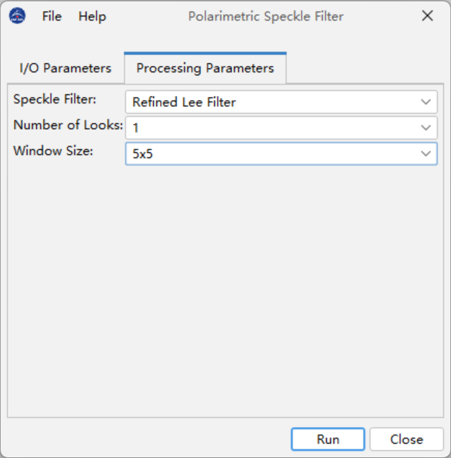
5 Speckle Filter(Lee 滤波)
Radar → Polarimetric → Speckle Filtering → Polarimetric Speckle Filter
保持极化信息时,Number of Looks = 1 是最推荐的选择。尤其是 农业、林业、平坦区域,对噪声去除要求较高,但不希望丢失过多细节。
Filter:Lee (我选的是Refined Lee Filter)
Window size:5 × 5 ⚠️ 不要过大(7×7 会抹平农田细节)
Source bands:C11, C12, C22
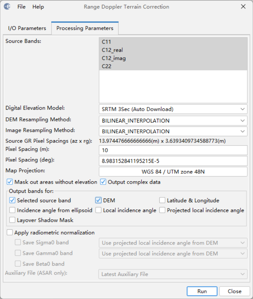
6 Terrain Correction(地形校正)
Radar → Geometric → Terrain Correction → Range-Doppler Terrain Correction
DEM:SRTM 3Sec(论文同款)
Pixel spacing: 10 m(若追求与 Sentinel-2 对齐,我选了10m) 或 20 m(算力友好)
Map projection:UTM(对应区号) WGS84 48N
✔ Save DEM band(可选)
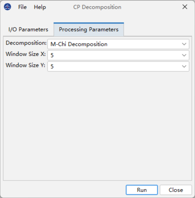
7 从 C2 提取 m-chi 特征
Radar → Polarimetric → Compact Polarimetry → CP Decomposition
Window Size推荐设置: 5 × 5(论文“隐含”默认)
最多 7 × 7
不推荐:
3 × 3(太噪)
7 × 7(抹平农田结构)
📌 理由:
m-chi 本质是统计散射
农田尺度下 5×5 是最稳的折中